
Sierra de Guadarrama as seen from Cercedilla hiking trails
So I’ve been a resident of Madrid for 5 weeks now (how did THAT happen) and although I absolutely love living in the heart of the city, I was starting to go a little stir crazy. I missed changing leaves, fresh mountain air and feeling soreness in my legs from climbing mountains – not just stomping around on cobble stones all day. So, I decided to do something about it…

Basically. Photo credit
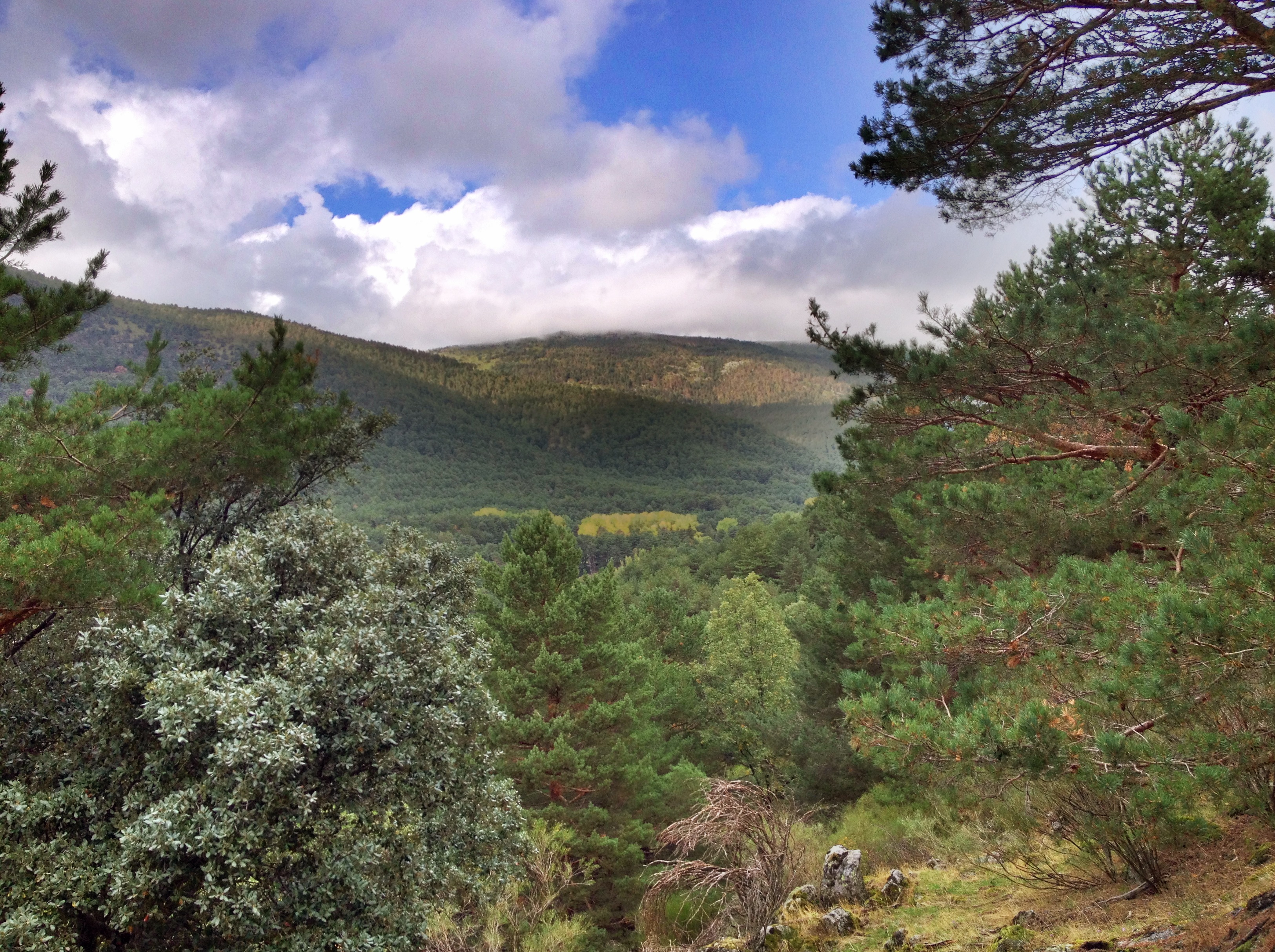
I’m complete sucker for the Great Outdoors. In the US, there are so many great places on both the east and west coast to hike and before I moved to Madrid, I was doing my part to try to see them all (check out my time in the mountains of Colorado and Utah!). I have a feeling my time in Spain will be no different. As soon as I started working at my school, I told all of my students how much I like to spend time outdoors and they’ve been so sweet as to give me suggestions on places outside of Madrid where I can hike and eventually ski come wintertime. The town of Cercedilla, located about an hour and 15 minutes outside of the Madrid city center, is a quaint mountain village of less than 7,000 people, and a very popular hiking spot.

Threatening clouds on the way to Cercedilla
I have to admit, I was a bit nervous on the way to Cercedilla. It rained the day before in Madrid and en route, it looked like the clouds were threatening to open up again. Luckily there was no torrential downpour, and the weather wasn’t much colder than it had been in Madrid. After arriving at the Cercedilla station, I walked the almost two kilometers to the Environmental Office where I picked up a hiking map and asked a few questions. Please note: these two kilometers might take the wind out of your sails before you even start your hike. I was definitely sweating and gasping for air and mentally counting it as part of my exercise for the day. The route to the office is a bit uphill and not clearly marked, so I had no idea if I was going in the right direction. Luckily I passed a few hikers who assured me that I was on target.

Trail map at the Environmental Office
After a quick chat with the park rangers, and taking into account how terribly out of shape I am, I decided on the relatively easy Camino del agua trail, which was 2 hours in duration, 5.7 km long and 1.3 meters at its highest altitude. The trail started at the Environmental Office and finished right back at the train station – perfect! There are eight trails to chose from, ranging from 2.5 km (1 hour) to 14.3 km (5 hours). All of the trails are very well marked by large dots of paint on select trees or rocks that correspond with the color of the trail on the map. It was literally impossible to get lost which really set my mind at ease.

Follow that blue dot!
The Camino de agua trail was perfect for all fitness levels and it passed a variety of scenery including ponds, deep forests and overlooks. Although the trail is very well maintained, be aware of rocks and tree roots that stick up from the ground (I tripped a few times) as well as horse poop! There is a horse farm nearby and I guess they occasionally walk the routes. I found Camino de agua to be very peaceful, so I stopped a few times to listen to the quiet, to meditate and to breathe. BREATHING. It’s amazing how often I forget to do that. There’s something about that moment when mountain air hits your lungs. Delicious! I wish I could have bottled the air in Cercedilla and brought some back with me to Madrid. At the end of the hike I was back in the “downtown” area so I grabbed a bocadillo before heading back to Madrid on the next train which left at half past the hour.

Overlooking the town of Cercedilla
There are two ways to get to Cercedilla from Madrid. One way is via the Cercanias trains system, also known as the best creation EVER, via the C-8 line which leaves from Atocha Renfe station. On Sundays, the C-8 train from Atocha Renfe departs for Cercedilla every hour on the hour and Cercedilla is the last stop. The ride takes just about an hour and 20 minutes. The other option is by bus on the 684 line which departs from the Moncloa Intercambiador at 40 minutes past the hour, every hour on Sundays. The ride is stated to take around 1 hour and 15 minutes depending on traffic.

Welcome!
A Crash Course to Hiking in Madrid/Cercedilla
- Board the C-8 Cercanias line from Atocha Renfe to Cercedilla (5.30 euro on Sunday) for a 1 hour 20 minute train ride OR board the 684 bus line from Moncloa Intercambiador for a 1 hour 15 minute bus ride to Cercedilla (3.70 euro).
- After arriving at the Cercedilla station, exit through the main doors and walk up the hill for 2 kilometers towards the Environmental Office. Note: before leaving the station, you may want to take the time to use the restroom and/or buy water and snacks before starting your hike.
- Ask the park rangers for a map so you can select you desired length and difficulty of your hike.
- Head out! Make sure to follow the colors of the trail but keep your map with you just in case.
- I suggest leaving Cercedilla by 6:30 pm/18:30 so you can enjoy the sunset on the way to Madrid, but make sure to double check when the last train heads back to the city.

My favorite part of the hike 🙂

The “agua” portion of Camino del agua

[…] travel companion for trips of the adventurous sort. As you all know, I love to hike and when I went hiking in Cercedilla, I realized I had no appropriate bag to carry important things like water, snacks, my cellphone, […]